
“The civility of no race can be perfect whilst another race is degraded.” -Ralph Waldo Emerson
Mt. Emerson is a peak on the Bishop skyline that sat on my to-do list for a while. I guess I didn’t have a partner. Or maybe I was intimidated by being in the backcountry alone. But earlier this year, a Montana-based friend made a climbing partner intro that helped me catch some stoke.
The Southeast Face (aka the Waterfall route) is a 5.4 scramble and local classic and I was pretty unsure how long it would take. The car to car times in various trip reports ranged from a 1-2 hour trail run to overnight epics. I was pretty confident this would be less than a full day for us, but the mountain project page was evidently designed to reduce the number of SAR trips required.
Totally valid, but it made it harder to calibrate. I gave us anywhere between 5 hours and 10 hours for a leisurely jaunt. It ended up taking 7, with a half hour detour for water and two long snack breaks.
The way there

We brought helmets and approach shoes. And we brought water filters. We ended up passing the last stream crossing before the cutoff without realizing it. That meant that we had to go out of our way an extra 30-40 minutes to get water. It added to our day, but the place we got water was pretty nice.
We got to the North Lake parking lot around 5am, and started hiking just as the sun was coming up. It’s a short approach through the forest, with a few creek crossings, up to the more rocky climber’s trail. The approach trail was pretty, and I had done it before on a hike up to Loch Leven.
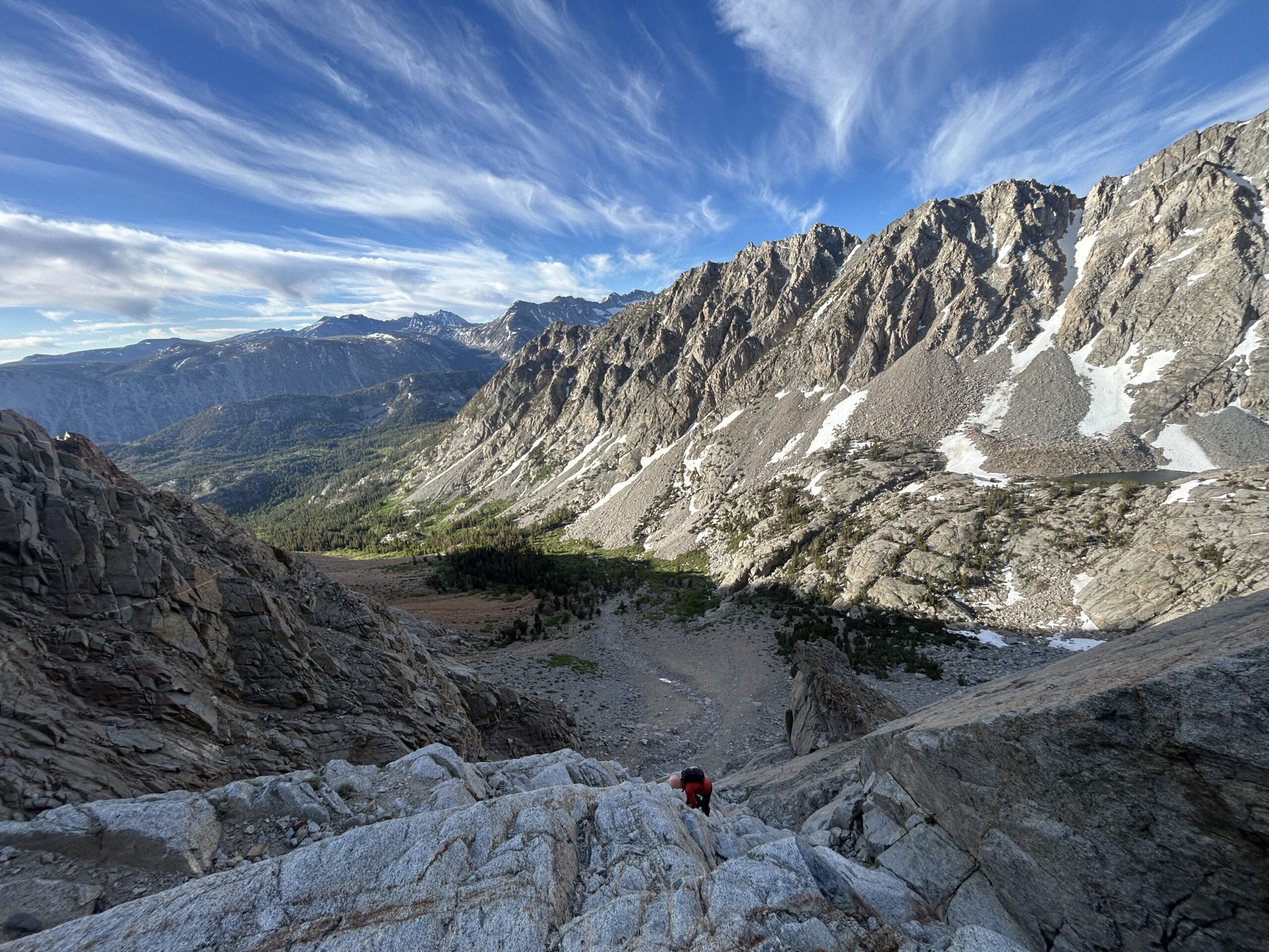
At some point, the route becomes visible and we exited the trail to go cross country. Lots of gpx coordinate links are available online, but I did not record ours. The base of the climb was an obvious crack. And I regularly complain when a guidebook refers to something as “obvious”, so this was really very clear.

We hiked up to the base and the start was probably the “crux”. It had maybe a maximum of two 5.4 moves within the first few “pitches”. The route finding was pretty straightforward by Sierra alpine standards. It was mid-June, and we encountered only one snow field in the route (at least I think it was on the route). We were easily able to dodge it by gaining the ridgeline via an earlier than normal point (I think), which was chossy.
The climbing was cardio for me, especially as we climbed to higher and higher altitudes. But the moves were all very reasonable and maybe one move was exposed. I definitely wouldn’t want to pitch this out for any reason. If I were bringing rope, I’d bring like a few pieces (nuts?) and the shortest rope I own.

Halfway (summit)

The summit was beautiful and offered clear views of so many peaks, including Mt. Humphreys, Checkered Demon, Mt. Darwin, and more. I ticked this climb with more additions to the to-do list, rather than less…. classic.

At the top we ate lunch and had a little wind. The coolest climbing is up high, gaining the summit block. There are airy, but easy, moves on very solid granite. The views of Paiute Crags are trippy, with their marbleized coloring… it reminded me of cinnamon bread or tie dye or something.

The plants up there were pretty interesting too… I found myself stopping to take pics (and not just because I was out of breath LOL). Maybe I’m easily entertained, but my own backyard never fails to impress me.


The way back
We found the descent pretty straightforward, despite trip reports indicating that it was not. Very ledgy, and lots of loose skree.

We bounced our way down until we hit a snow patch. We didn’t bring any ice axes, but decided to glissade anyway (with rocks). Maybe not my best decision, but it was fine and much quicker than walking down the loose stuff.
I was pretty happy to hit solid ground on the trail. We got eyes on Loch Leven, where folks were fishing, and decided to stop for snacks and water.

It occurred to me later that we summited Mt. Emerson on the same day as the politically active nationwide were demonstrating against the ICE kidnappings.
The peak is named for Ralph Waldo Emerson, who has his own controversy, but who famously said “The civility of no race can be perfect whilst another race is degraded.” and I thought that was appropriate for the day.